
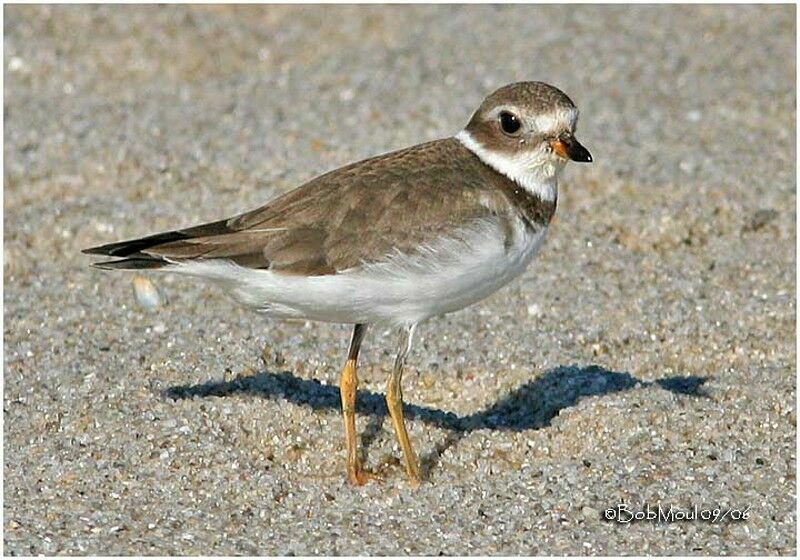
Semipalmated Plover - Charadrius semipalmatus
Gravelot semipalmé
The species
Classification
Order : Charadriiformes
Family : Charadriidae
Species : Semipalmated Plover
Geographic range by countries
specie's pictures
The picture
O.Net ref. : bomo23868
Author :
B. Moul
Nature Photography
Shooting
date : 2006 Sep
Country :
United States (us)
Region : New Jersey
Place : Sherrill Flying Service Airport
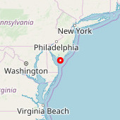
Lat. : 38° 56' 30'' North
Lng. : 74° 54' 36'' West
Exif Data [+] [-]
Model : Canon EOS 20D
Exposure : 1/1600 s
aperture : 10
Focal length : 420 mm
Iso : 400
Flash : no